
Pond Design
Ben - We live in SE Vermont mountaintop elevation 1500’ DFB - 40” rain/year. Goals are to establish a 1/4 - 1/2 acre pond using 1 or 2 springs and swale redirected surface water for wildlife habitat, recreation, crop irrigation and beauty. Following up on my question from the first class with more context.
Arial View of Property from South
View from above the test pit, panning north to the house then west to the spring area.
Maps
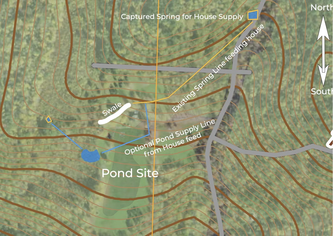
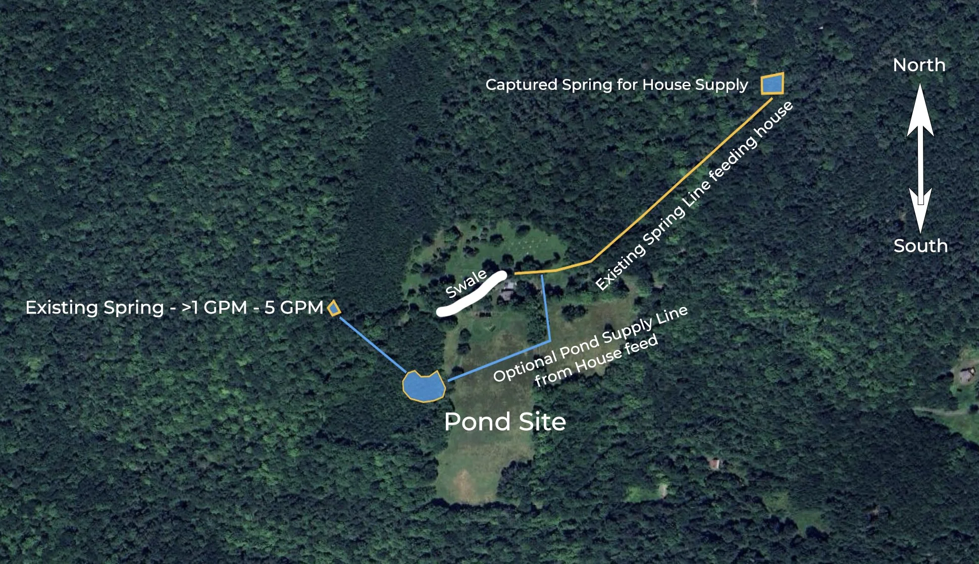
The spring to the West is semi captured and flowing through a pipe and mostly captured by a retaining pool below the spring (see photo/video below) it produces 5 GPM + this time of year, and in the middle of the drought last year, >1 GPM but still produced. I am going to redirect it from the retaining pool down to the pond site, which is about a 20’ drop in elevation through a 1 inch pipe.
Western Spring
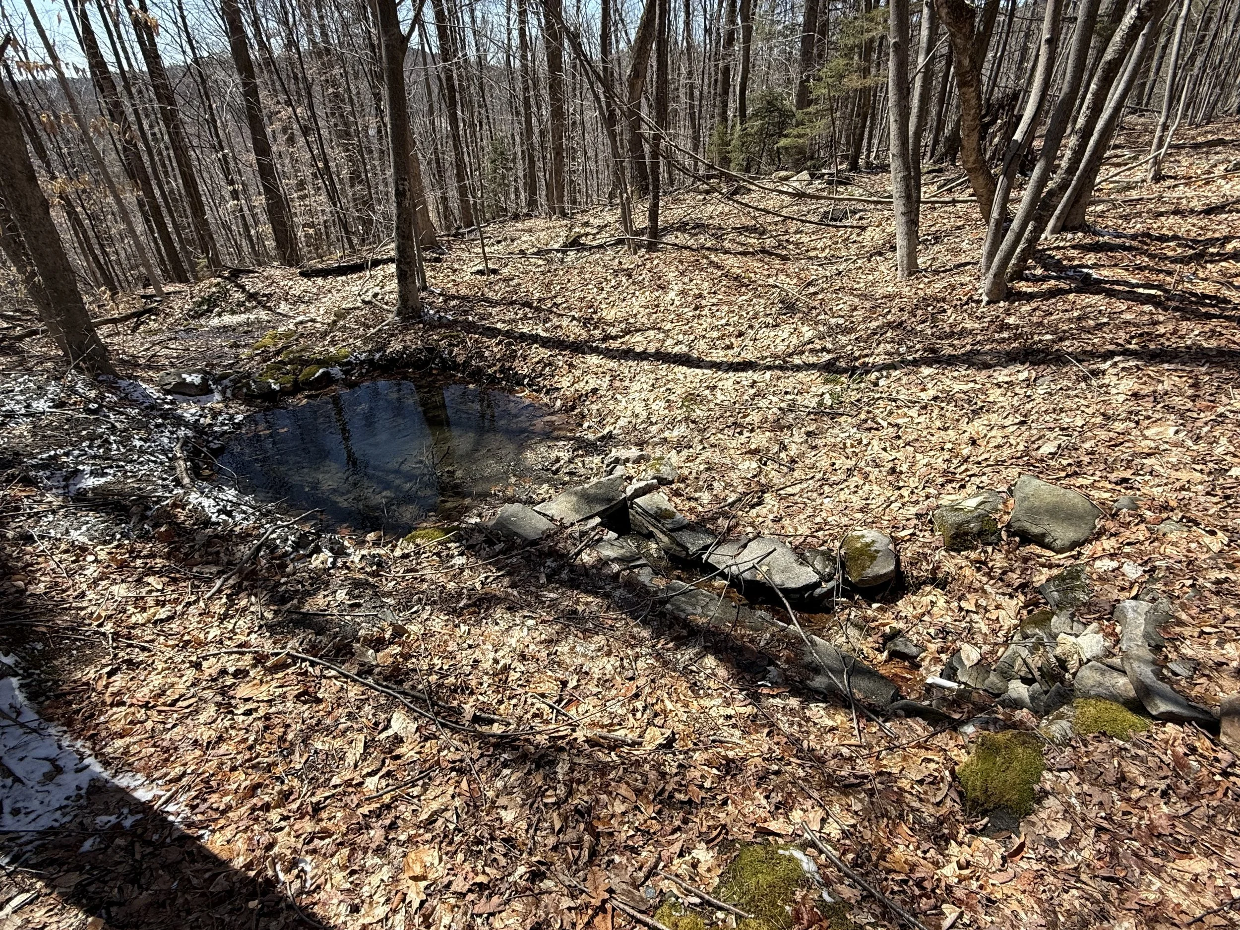
Pond Site/Test Pit
This is the test pit, dug in fall of last year when it was very dry. It stayed largely dry until the rains came back then the pit stayed mostly full to half full throughout winter. The water level was variable though. There is a long swale above the site which redirects all surface flow above the house into this area (which can be significant).
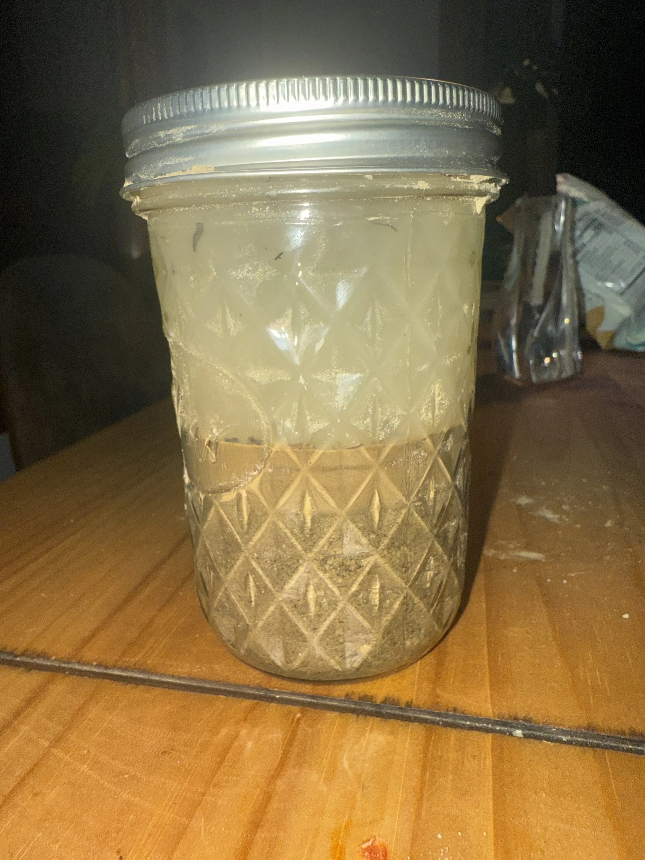
Soils are a fine sandy variety. And a sample from the soil removed from the bottom of the test pit looks like %20 clay?
Eastern Spring/Gravity Fed House Supply

Spring Box for our driving water, showing the surrounding ground where the spring seeps into when house supply (300 gallon in-basement cistern) is at 100% capacity
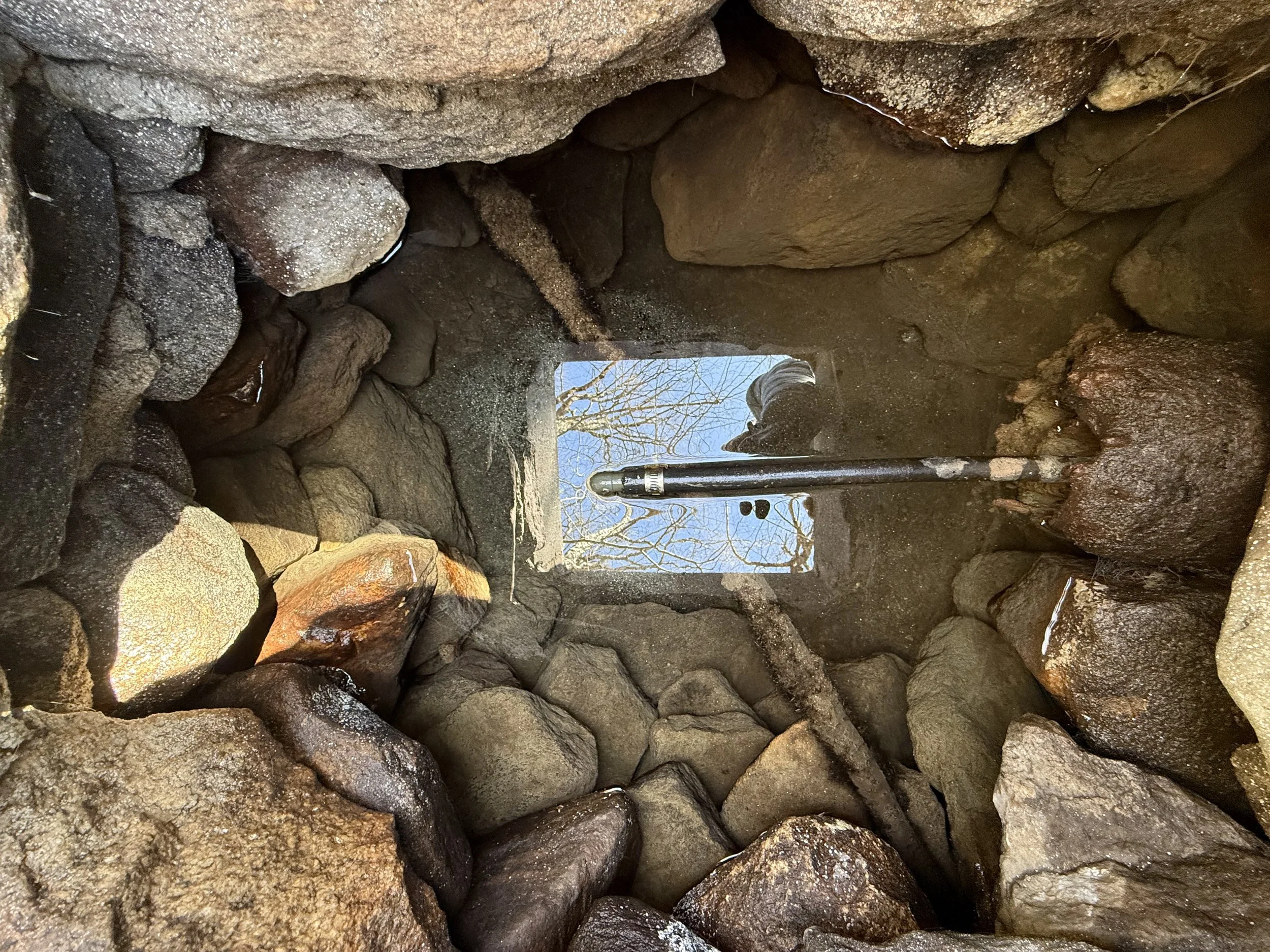
Looking into spring box showing supply line to house. When house is at-capacity, excess water naturally percolates out the log pip holding the supply line and into the surround in soil.
This is a quick video of the seeps bubbling up at the bottom of the spring box. This has been a very reliable water source for decades (knock on wood). It produces 1 - 3 GPM.